

Never miss what is happening in Sussex County
Events, new openings and weekend plans from Newton to Vernon, Sparta to Stanhope. Straight to your inbox, free.
The best-known waterfalls in Sussex County NJ sit in the far western corner of the county, along the Kittatinny Ridge in Walpack and Sandyston, inside the Delaware Water Gap National Recreation Area and Stokes State Forest. The headliner is Buttermilk Falls, which the National Park Service calls New Jersey’s tallest waterfall, and the quieter pick is Tillman Ravine in Stokes State Forest.
Both are free to visit, both are reached by back roads, and both come with seasonal road closures that can stop you before you ever reach the trailhead. Our team pulled every detail below from the National Park Service and NJ State Parks, so you know exactly how to get there, where to park, and what to check before you leave the house.
Waterfalls in Sussex County NJ at a glance
- Buttermilk Falls, Walpack Township: the big one. A tall cascade right beside Mountain Road, with a staircase trail that climbs to the Appalachian Trail.
- Tillman Ravine, Stokes State Forest: a shaded hemlock ravine along Tillman Brook with a short trail loop through a state Natural Area.
Sussex County is not packed with roadside waterfalls the way some regions are. What it does have is one genuinely impressive fall and one beautiful ravine, both a short drive from each other, which makes for an easy half day in the woods.
Buttermilk Falls (Walpack Township)
What to expect
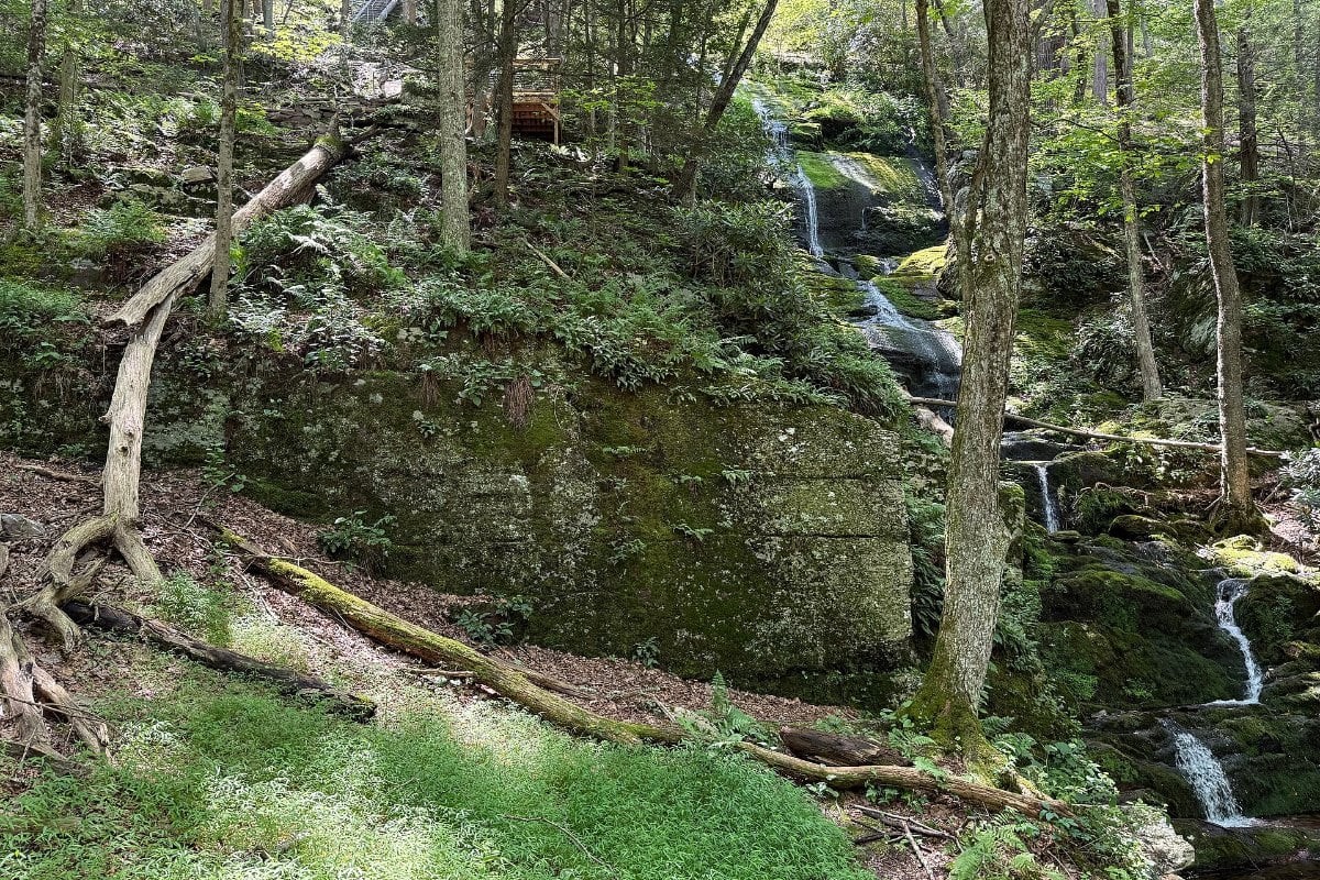
Buttermilk Falls sits right off Mountain Road, a gravel backroad near Walpack Center. The National Park Service describes it as “New Jersey’s tallest waterfall,” and a 2021 park news release put its height at 75 feet. The best part for families: the falls sit right beside the road, so you can see them without committing to a hike. The park service lists it as an accessible waterfall viewing spot.
If you want more, a wooden staircase climbs the side of the falls past observation platforms. The park rebuilt the staircase and two observation platforms in 2021, using rot resistant black locust from storm toppled trees inside the park.
The Buttermilk Falls Trail
Per the National Park Service’s Buttermilk Falls Trail page, the trail is 1.4 miles one way, rated moderate to difficult, with an elevation change of 1,104 feet. It is a steep climb up to the ridge, where it meets the Appalachian Trail. From there, hikers can head south on the Appalachian Trail to reach the Crater Lake and Hemlock Pond loop trails. Plan on a full out and back if you go to the top, and wear real shoes: the stairs and rock can be wet from spray.
How to get there and where to park
This is the part that trips people up. According to the park service, Mountain Road is reached from Struble Road in Stokes State Forest. As of the park’s current conditions page, Mountain Road is closed to vehicles beyond the bridge and from the south end at Haneys Mill while repairs are made to a state owned section, and the Main Street bridge between Walpack Center and Mountain Road remains closed due to structural damage. In plain terms: do not try to approach from Walpack Center or from Haneys Mill. Come in from Struble Road through Stokes State Forest, follow Mountain Road to the falls, and park only in designated spots, never on the road shoulder or blocking the gravel lane.
Mountain Road is gravel, so take it slow, especially after rain.
Seasonal closures
The park service notes that Struble Road in Stokes State Forest is closed from December 15 through April 15 every year, and when it is closed you cannot drive to the falls. A park release also notes that Mountain Road closes to vehicles each winter on January 1 or after the first significant snowfall, whichever comes first. Because these dates and the repair closures change, check the Delaware Water Gap current conditions page before you go. Late fall is a great time to visit, but a visit in winter or early spring will likely be on foot only, if at all.
Rules at the falls
Per the park’s swimming rules, swimming is not permitted within 50 feet of the top of any waterfall. Stay on the staircase and platforms, and keep kids and dogs back from the edges.
Tillman Ravine (Stokes State Forest)
What to expect
Tillman Ravine is a protected Natural Area inside Stokes State Forest, and the National Park Service includes it on its Delaware Water Gap waterfalls page alongside the park’s own falls. Tillman Brook runs through the ravine under a canopy of hemlocks. Think of it as the calm, shaded counterpart to Buttermilk Falls: smaller water, more atmosphere, and a much gentler walk than the Buttermilk staircase.
The trail
The NJ State Parks Stokes State Forest trail map lists the Tillman Ravine Trail at 1.5 miles and includes a detailed inset map of the Tillman Ravine Natural Area. Download or print that map before you go; it shows the trail and the parking areas around the ravine.
Pairing it with Buttermilk Falls
Because the recommended route to Buttermilk Falls runs through Stokes State Forest, Tillman Ravine fits naturally into the same trip. Our suggestion: do the Buttermilk Falls staircase first while your legs are fresh, then cool down with the ravine walk. Since Struble Road closes for the winter, plan this combo between mid April and mid December.
Know before you go
- Fees: The Delaware Water Gap National Recreation Area charges no entrance fee. Per the park’s fees page, the only New Jersey site with an expanded amenity fee is Turtle Beach ($10 per vehicle per day, which was charged through October 13, 2026). Buttermilk Falls is not on the fee list.
- Roads change often: Between seasonal closures and ongoing repairs, the roads in Walpack are the biggest variable. As of the park’s spring 2026 conditions update, Old Mine Road is also closed between Route 206 and Jager Road for a repaving project, and Route 615 between Flatbrookville and Pompey Ridge is closed due to landslide activity. Check the conditions page the morning you go.
- Navigation: Download offline maps and the park and state forest maps before you leave. Do not rely on your phone’s route choice in this corner of the county, since the closed bridges and road segments are exactly where a GPS will try to send you.
- Footwear: The Buttermilk staircase and Tillman Ravine trail are rocky and often damp. Wear shoes with grip.
- Best timing: Waterfalls run strongest after rain and in spring, but spring visits depend on Struble Road reopening April 15. Fall brings foliage and fewer crowds.
- Questions: The Delaware Water Gap National Recreation Area can be reached at 570-426-2452.
If you are making a day of it, pair the falls with one of our fall foliage hikes in Sussex County, or head north for the views in our High Point State Park fall foliage guide. For more ideas this season, see our list of things to do in Sussex County in October.
Frequently Asked Questions
What is the tallest waterfall in New Jersey?
The National Park Service calls Buttermilk Falls in Walpack Township, Sussex County, New Jersey’s tallest waterfall. A 2021 park release listed it at 75 feet.
Is Buttermilk Falls free?
Yes. The Delaware Water Gap National Recreation Area has no entrance fee, and Buttermilk Falls is not one of the park’s fee areas.
How long is the Buttermilk Falls hike?
You can see the falls from beside Mountain Road with almost no walking. The full Buttermilk Falls Trail is 1.4 miles one way with 1,104 feet of elevation change, climbing to the Appalachian Trail.
How do you get to Buttermilk Falls in NJ?
Take Struble Road through Stokes State Forest to Mountain Road. As of the park’s latest conditions update, Mountain Road is closed to vehicles from the Haneys Mill end, and the Main Street bridge from Walpack Center is closed, so the Struble Road approach is the way in.
Can you visit Buttermilk Falls in winter?
Usually not by car. Struble Road closes from December 15 to April 15 each year, and Mountain Road closes to vehicles for winter as well. Check the park’s conditions page before planning a cold weather visit.
Get Sussex County in your inbox. Our free weekly newsletter rounds up the best events, food and outdoor ideas across all 24 towns. Subscribe free here.
Primary sources for this guide: NPS Buttermilk Falls, NPS Buttermilk Falls Trail, NPS 2021 Mountain Road and trail reopening release, NPS Delaware Water Gap current conditions, NPS Delaware Water Gap waterfalls, NPS fees and passes and the NJ State Parks Stokes State Forest trail map.
Featured photo: Buttermilk Falls in Walpack Township. Photo by Famartin via Wikimedia Commons, CC BY-SA 4.0.
Have a Sussex County event coming up?
Share it with Sussex County.
Festivals, fundraisers, 5Ks, school nights, grand openings. Send us the date, time, place and a flyer, and our team will reach out about getting it in front of Sussex County.
Enjoying our Sussex County coverage?
Add us as a preferred source and our stories show up higher in your Google results.
Add as a preferred source